
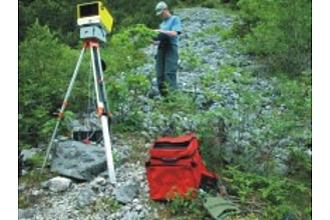
bodengestützter Laserscanner ILRIS-3D
Martin-Luther-Universität Halle-Wittenberg
Naturwissenschaftliche Fakultät III
Institut für Geowissenschaften und Geographie
Von-Seckendorff-Platz 4
06120 Halle (Saale)
Tel.:+49 345 5526010
Fax:+49 345 5527068
Gerätebeschreibung
Technische Daten des ILRIS-3D (Quelle: www.optech.com)Performance
Sample Rate 2500 points per second
Beam divergence 0.00974°
Minimum spot step (X and Y axis) 0.00115°°
Raw range accuracy 7 mm @ 100m
Raw positional accuracy* 8 mm @ 100m
Laser wavelenght 1500 nm
Laser class (IEC 600825-1) Class 1
Digital camera Integrated high resolution digital camera, (CMOS sensor) optional external camera
Scanner field of view (ILRIS-3D) when mounted at the rotation unit -20° through 90° (V) x 360° (H)
-90° through 20° (V) x 360° (H)
Scanner field of view (ILRIS-3 D) 40° x 40°
Physical Size
Scanner weight and physical size 13 kg, 320 (L) x 320 (W) x 220 (H) mm
Rotating base weight and physical size 10 kg, 300 (L) x 280 (W) x 127 (H) mm
Power supply and consumption 24 VDC, 75 W
Battery life (standard battery pack) 5 hours operation, hot-swappable for continuous operation
Data storage Solid State, removable USB memory field interchangeable
External GPS and digital camera mounts -
Standard software Data output to a variety of metafile and X Y Z coordinates, including active laser intensity photograph and digital photo
Environmental
Operating temperature 0° C to 40° C
Storage temperature -20° C to 50° C
Projekte
Weitere Geräte dieser Struktur
- Ar/Ar-Laser Massenspektrometer
- Elektronen-Mikrosonde (Mineralchemismus - Thermobarometrie)
- Hand-held XRF Analyser Niton XL3t 900
- Hg-Messung
- ICP
- Ionenchromatographie
- Massenspektrometer (Uran-Blei Datierung: Zirkon, Monazit; Ar-Ar: Glimmer)
- Mikrofocus-Röntgenanlage, Geologisches Institut Halle
- Mikrofokus-Röntgenanlage des Geologischen Instituts Halle zur Diagnostik
- Mikroskopie
- Nautilus C 2000
- Prüfmaschine bis 5000 kN mit Triaxialzelle bis 1 kbar
- Rasterelektronenmikroskop
- Röntgen diffraktometer Mit Klimakammern
- Röntgendiffraction XRD
- Röntgendiffraktometer
- Röntgendiffraktometer mit schnellem Detektor X-celerator
- Röntgendiffraktometer mit speziellen Messzellen
- Röntgenfluoreszenz (Gesamtgesteinschemismus - Metamorphosebedingungen)
- Terra-Spec SWIR-Spectrometer (mobil)
- Thermoanalyse mit EGA-Zusatz
- VNIR-SWIR-Geländespektrometer ASD FieldSpecPro
- XRD
- XRF